
LAZY SURVEYOR
Leírás
Welcome to our surveying app designed to revolutionize your daily routines! With our tool, importing and exporting data between Autodesk® AutoCAD® and total station txt/sdr/gsi formats is a breeze. Our comprehensive features make surveying tasks easier - because sometimes, the easiest way is the laziest way!
Our comprehensive features include:
Import Options: Seamlessly bring in data from total station txt/sdr/gsi formats. Users can customize point height, text height, and rotation angles for texts during import.
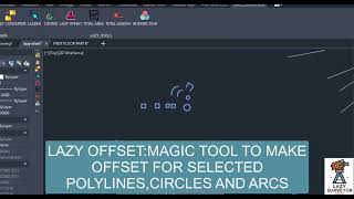
Exporting Methods: Choose from various export methods such as picking points, selecting points, selecting polylines, selecting polylines with an offset value, selecting centers, and selecting blocks. Export your data to sdr, txt, or gsi formats. Additionally, it generates reports in AutoCAD table format.
Data Conversion: Effortlessly convert data between AutoCAD and total station txt/sdr/gsi formats. Our tool ensures smooth transitions between different data types, facilitating seamless data management.
Intersection Tool: Instantly draw points at the intersections of objects, aiding in precise and efficient surveying tasks.Leader Functionality: Utilize the leader tool to draw multileaders for coordinates at selected points, enhancing clarity and organization in your projects.Measurement Capabilities: Easily obtain area and length measurements for selected objects, providing valuable insights for your surveying projects.
Table Tool: Add a table tool to write coordinates inside the table for selected points and control the number of points in the table.Label Tool: Add a label tool to write coordinates next to points.
Average Tool: Add an average tool to calculate point averages. Our app is meticulously crafted to enhance your efficiency, accuracy, and overall surveying experience. Say goodbye to tedious tasks and embrace a streamlined workflow with our comprehensive suite of tools. Elevate your surveying endeavors with our innovative app today!


Lazy Surveyor is considered one of the useful programs for surveyors, especially those who work with total station or GPS files and need to quickly prepare data, draw it, or generate reports.
ما شاء الله
إضافة ممتازة وسهلة جدا
إنجاز الكثير من المهام في وقت قصير جدا
Thanks for the download program
100% Very good 😊👍
Thanks 🙏 👍
good day sir..will this perfectly work with lower version of autocad like 2013?
Good day! The software typically performs best with higher versions of AutoCAD. While it may be possible to run it on AutoCAD 2013, compatibility issues could arise, and some features might not work as intended. For optimal performance and functionality, it’s recommended to use the latest version of AutoCAD between 2013:2026.
الحقيقه برنامج مميز , اهم ما يميزة اوامر كثيرة نحتاجها في ايقونه واحدة, بالتوفيق باشمهندس
Thank you for your kind words and thoughtful comment! Wishing you all the best, Engineer yahia !
The Lazy Surveyor app is a game changer. The automated features save me so much time, and the accuracy is spot on. The user interface is intuitive, making it easy to navigate through different tools. I highly recommend it for anyone in the surveying field!"
Best Regards
Mostafa Hegazy
Thank you for your kind words! iam thrilled to hear that Lazy Surveyor is helping streamline your surveying tasks. Your satisfaction is our top priority, and we're constantly working to improve the app. If you have any suggestions for future updates, please don't hesitate to let us know!
.
Thank you for your kind words, Dear Friend!
ما شاء الله عليك م.احمد حسن علي البرنامج الجبار ده تسلم والله
thanks my friend ,,i hope you enjoy the app