
SPCAD

Digitally signed app
Description
SPCAD for Autodesk® AutoCAD® is an Add-on equipped with more than 150+ tools, to make AutoCAD workflows quick, efficient, and convenient. SPCAD promises a comprehensive CAD solution that automates CAD tasks without compromising accuracy or the need to switch between different applications.
Key features
Import and export a diverse range of geospatial file formats within the CAD environment.
Assign projection systems using a country-sorted rich database with the ability of custom transformations (units/coordinate systems) for AutoCAD drawings.
Download georeferenced Bing Map Images.
Flexible options to extract and modify cross-sections and profiles.
Generate surface areas and volumes for reservoirs and stockpiles.
Choose from assorted possibilities to subdivide lots and manage parcels.
Enhance map-making with auto-generated map elements like legends, scale bars, north arrows, and a built-in library of symbols.
Data-driven atlas compilation using a predefined template for interrelated drawings like strip data or polygonal area.
Clip drawings for local area working with efficient memory management.
Geometric tools to facilitate conversions for circles, arcs, 2D/3D polylines, bisecting angles, and creating curved arrows.
Miscellaneous tools like shrink-wrap, convex hull, cut/merge polygons and create buffers for points, lines, or polygons.
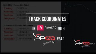
Users can geo-reference raster data, compare TINs, import/export DEMs, and find the area of influence around points using Voronoi polygons. They can also convert intersecting features into polygons. The TIN Manager allows users to efficiently manage TIN surfaces, while TIN Merge helps combine multiple TINs into a single surface. Some tools enhance productivity, such as measuring ground distance, creating quick contours, generating profiles and cross-sections, and tracking cursor coordinates in two different coordinate systems.
Check out this blog to learn more: https://cadomation.com/key-features-of-spcad-for-autocad/
Note: This app uses a custom installer (and not the standard App Store installer).
For activation of the trial, watch the video:
https://youtu.be/9rDagYNcHn8?si=pq8B4FR-ETHcLFMf
A registration form will appear on the first run, requiring the Name, Email, Phone Number, Country, and Organization.
Fill out the form, click on "Register," and you will be sent a 5-digit code by CADOMATION on the provided email.
Enter the activation code to activate a fully functional trial for 14 days!
SPCAD supports English, Spanish, Polish, Greek, and Portuguese. (LANG_SP Command)
Note: The previous version of SPCAD must be uninstalled first from Control Panel to install the current version.
Trial Description
Fully functional for 15 days trial with Spanish Language Support.


This application it's a powerful tool colection for all splecialists involved in civil engineering works. The different types of datums, the parcels management system creating DTM model, sections an others are a big help for land surveyors. I recomend it.
The idea of this addition is very useful and wonderful. I strongly support and thank the genius programmer for this excellent work and tremendous effort.
spcad is very user friendly and significantly reduuced my workload.its like multiple softwares at one place.
As an AutoCAD user, I was constantly frustrated with switching between apps for geospatial data and map creation. SPCAD is a lifesaver! It's packed with over 100+ tools that handle everything from importing geospatial files to generating stunning maps with automatic elements. No more app switching, just pure AutoCAD efficiency. Download SPCAD and take your CAD experience to the next level!
SPCAD's ingenious features with user-friendly interface have provided me with a simplistic but reliable CAD resource for almost all of my topographic and terrain analysis workflows.
It saved my time when dividing Lot in multiple parcels.