
GeoCode
Win32 and 64, EnglishGeneral Usage Instructions
Set your personal Google Maps or W3W API keys before the first usage - see Help and the GEOCODEAPIKEYS command.
Load the GEOCODE utility and choose the function from the GeoCode ribbon tab. You can also use two LISP interfaces for reverse geocoding (works in any version of Autodesk® AutoCAD®) - e.g.: revgeocodeLL '(48.9669 14.4768)) evaluates to: "Tylova 153/17, 370 01 Ceske Budejovice, Czech Republic" nonsense coordinates evaluate to "ZERO_RESULTS" and: (revgeocode (getpoint)) works as the GEOCODE command, returns the address string. You can also use a LISP interface function to convert an address to a lat-long point: (geocodeLL "Tylova 17, Ceske Budejovice") returns a list: (48.9666 14.4768).
And in the what3words variant - the function: (revgeocodeLLW3 '(48.9669 14.4768)) evaluates to: "purses.casually.question" and the function (geocodeLLW3 "purses.casually.question") returns a list: (48.9669 14.4768).
You can preset your personal Google and what3words API keys through LISP variables - e.g.:
(setq GoogleAPIkey "AaAaAaAaAaAaAaAaAaAaAaAaAaAaAaAaAaAaAaA")
(setq w3wAPIkey "12345XYZ")(setq w3wlang "fr")
or through the command GEOCODEAPIKEYS.
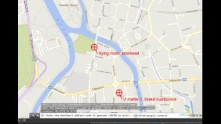
Screenshots


Commands
| Ribbon/Toolbar Icon | Command | Command Description |
|---|---|---|

|
GEOCODEAW3 |
Uses the what3words service to convert a 3-word address code to a location (position marker). |

|
GEOCODE |
The GEOCODE command performs reverse geocoding - it converts a picked point to its postal address. Pick a point and GeoCode will display its full street address (or the address of the nearest location). In AutoCAD you need to first set the _GEOGRAPHICLOCATION (use the WORLD-MERCATOR coordinate system) and your current layer must be ON. In Autodesk® Map / Autodesk® Civil 3D® you need to first set the coordinate system of your map. |

|
GEOCODEA |
The GEOCODEA command performs standard (forward) geocoding - it prompts for a full address (free-format text string) and returns its lat-long coordinates plus it creates a geomarker on this position (with the address as its label). You can also paste a list of addresses e.g. from Excel. |

|
GEOCODEW3 |
Uses the what3words service to convert a location to a 3-word address code. |
Installation/Uninstallation
The installer that ran when you downloaded this app/plug-in from Autodesk App Store will start installing the app/plug-in. OR, simply double-click the downloaded installer to install the app/plugin. You may need to restart the Autodesk product to activate the app/plug-in. To uninstall this plug-in, exit the Autodesk product if you are currently running it, simply rerun the installer, and select the "Uninstall" button. OR, click Control Panel > Programs > Programs and Features (Windows 10/11) and uninstall as you would any other application from your system.
Additional Information
Known Issues
Contact
Author/Company Information
Support Information
Email us at info.cz@arkance.world for support, feedback or requests for enhancements.
Version History
| Version Number | Version Description |
|---|---|
|
1.7.0 |
Added AutoCAD 2017/2018/2019/2020/2021/2022/2023/2024/2025/2026/2027 support Added the Google Maps API key support Added the what3words geolocation service support, V3 Added the GEOCODEAPIKEYS command to enter your API keys Keep option for labels |
|
1.6.0 |
Added AutoCAD 2017/2018/2019/2020/2021/2022/2023/2024/2025/2026 support Added the Google Maps API key support Added the what3words geolocation service support, V3 Added the GEOCODEAPIKEYS command to enter your API keys Keep option for labels |
|
1.5.0 |
Added AutoCAD 2017/2018/2019/2020/2021/2022/2023/2024 support Added the Google Maps API key support Added the what3words geolocation service support, V3 Added the GEOCODEAPIKEYS command to enter your API keys |
|
1.4.0 |
Added AutoCAD 2017/2018/2019/2020/2021/2022 support Added the Google Maps API key support Added the what3words geolocation service support, V2 |
|
1.3.0 |
Added Autodesk® AutoCAD® 2017/2018/2019 support Added the what3words geolocation service support, V2 |
|
1.2.0 |
Added AutoCAD® 2017 support Added the what3words geolocation service support |
|
1.0.0 |
Added AutoCAD® 2017 support |
