
ArcGIS for Autodesk® AutoCAD®
Win64, EnglishGeneral Usage Instructions
Collaborate across CAD and GIS teams.
Collaboration between GIS and CAD teams is bolstered through the use of ArcGIS for AutoCAD. GIS managers gain a means of managing access to GIS data by CAD professionals while avoiding piecemeal requests to repackage and provide data for consumption in CAD environments. CAD teams readily draw from their organization's content, sidestepping potential delays in obtaining manually requested data from the GIS team. Both the GIS and CAD teams remain confident as to which design datasets are up to date.
Contextualize and inform designs with spatial information
ArcGIS for AutoCAD weaves together precise CAD geometry and associated spatial information. CAD professionals contextualize and inform designs by bringing Esri maps and curated content from the ArcGIS Living Atlas of the World into their CAD environments. GIS data stored in ArcGIS Online and ArcGIS Enterprise is also leveraged by ArcGIS for AutoCAD. Namely, feature services are used so that rich GIS datasets can be brought into, created within, and synchronized as part of workflows in CAD environments.
CAD professionals routinely need to assign coordinate systems and position design content so that said designs can be combined with other design assets, further analyzed, or reviewed by stakeholders outside of CAD environments. ArcGIS for AutoCAD provides several avenues for assigning projected coordinate systems and geographic coordinate systems, including custom coordinate systems, to CAD files. For collaborative workflows, georeferencing within the CAD environment additionally precludes painstaking efforts to track down positioning information by other project collaborators.
Geospatially enable workflows
ArcGIS for AutoCAD provides two-way synchronization of hosted feature layers in ArcGIS Online and ArcGIS Enterprise. Named user account privileges are honored, allowing GIS managers to establish appropriate access for CAD team members. The workload on the GIS manager for data requests is then reduced as the CAD team instead 'self-serves' using ArcGIS for AutoCAD, which in turn eliminates the CAD manager’s concerns about turnaround times for data requests. The CAD manager also sees that bringing in content through feature services ensures that the latest datasets are used and that CAD professionals can fully participate in GIS processes in ways that complement their established workflows.
For more details, visit the Get Started with ArcGIS for AutoCAD tutorial series.
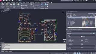
Screenshots


Commands
| Ribbon/Toolbar Icon | Command | Command Description |
|---|---|---|

|
ESRI_RIBBONRESET |
A diagnostic command. If the ArcGIS ribbon tab doesn’t initialize correctly on start-up, this command initializes the tab. |
Installation/Uninstallation
Step-by-step instructions for installing the latest version of ArcGIS for AutoCAD are found here.
Additional Information
Known Issues
Contact
Author/Company Information
Support Information
Reach out to support@esri.com for technical support on ArcGIS for AutoCAD. Visit Esri Community to post questions and participate in product discussions.
Help us drive new capabilities and enhancements to future releases by posting your product ideas for consideration.
Version History
| Version Number | Version Description |
|---|---|
|
440.0.0 |
- Release date: 11/21/2025 - Latest release notes: https://link.esri.com/afa-440-release-notes - Check out our blog for details: https://link.esri.com/afa-440-whats-new |
|
435.0.0 |
- Release date: 1/23/2025 - Latest release notes: https://doc.arcgis.com/en/arcgis-for-autocad/latest/get-started/what-s-new-in-arcgis-for-autocad.htm - Check out our blog for details: https://www.esri.com/arcgis-blog/products/autocad/announcements/whats-new-in-arcgis-for-autocad-january-2025 |
|
435 |
- Release date: 1/21/2025 - Latest release notes: https://doc.arcgis.com/en/arcgis-for-autocad/latest/get-started/what-s-new-in-arcgis-for-autocad.htm - Check out our blog for details: https://www.esri.com/arcgis-blog/products/autocad/announcements/whats-new-in-arcgis-for-autocad-january-2025 |
|
430.1.1 |
- Release date: 11/05/2024 - Latest release notes: https://doc.arcgis.com/en/arcgis-for-autocad/latest/get-started/what-s-new-in-arcgis-for-autocad.htm - Check out our blog for details: https://www.esri.com/arcgis-blog/products/autocad/announcements/version-430-1-1-of-arcgis-for-autocad-enhances-synchronization-with-arcgis-online/ |
|
430.1 |
- ArcGIS for AutoCAD brings new features and enhancements that strengthen collaborations between CAD and GIS teams. For example, recently added support for branch versioning enables multiple CAD editors to work simultaneously on web feature layers while GIS users track changes through time. This also includes an extension that aids indoor GIS workflows and smooths the preparation of CAD floorplan content for later consumption in ArcGIS Pro. -Release date: 5/16/2024 -Latest release notes: https://doc.arcgis.com/en/arcgis-for-autocad/latest/get-started/what-s-new-in-arcgis-for-autocad.htm |
