
Plex-Earth 2026
Win32 and 64, EnglishGeneral Usage Instructions
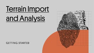
Plex-Earth consists of 5 parts.
- Georeferencing
- Importing Imagery
- Importing Terrain
- Historical Imagery (Timeviews - monitor an area or project over time)
- Google Earth Visualization
For additional information and getting-started tutorials, please visit https://goto.plexearth.com/pe26-appstore/getstarted
Screenshots


Commands
| Ribbon/Toolbar Icon | Command | Command Description |
|---|---|---|

|
PXV_SIGN_IN |
Start a new Plex-Earth session. |

|
PXV_GEO |
Specify the georeference of the project/drawing. |

|
PXV_QUICKVIEW |
View Google Maps imagery for the current viewport or a specific area in the drawing. |

|
PXV_NEWSITE |
Create a Site Area to define and visualize your area of interest. Set boundaries, load imagery and terrain, and view the most recent or historical imagery for a comprehensive project overview. |

|
PXV_NEWPOI |
Create Point(s) of Interest to mark specific locations within your project area. See an aerial preview and access recent and historical imagery for detailed analysis. |

|
PXV_COLLECTION_MANAGER |
View and manage all data collections, including site areas, POIs, and more, for a comprehensive project overview. |

|
PXV_IMAGERY |
Import an image to cover an area specified in Autodesk® AutoCAD®. |

|
PXV_TERRAIN |
Imports terrain to a polygonal area specified by a window or polyline in AutoCAD. |

|
PXV_TERRAIN_FROMGEOTIFF |
Generate a terrain model using elevation data from a GeoTIFF file. You will be prompted to select the file. |

|
PXV_TERRAIN_FROMOBJECTS |
Creates surface from the selected points, lines and polylines in AutoCAD. |

|
PXV_TERRAIN_FROMFILE |
Creates a surface from an external points file (e.g., txt, csv, xyz). |

|
PXV_TERRAIN_FROMMESH |
Creates a surface from a mesh object selected in AutoCAD. |

|
PXV_GE_VIEWSYNC |
Synchronizes the camera of Google Earth to match with the current view of AutoCAD. |

|
PXV_GE_VIEWAREA |
Zooms Google Earth into a specified area of the drawing. |

|
PXV_GE_VIEWPOINT |
Zooms Google Earth camera to focus a position specified by the user in the drawing. |

|
PXV_GE_VIEWCAM |
Align the view of Google Earth to a camera specified in AutoCAD. |

|
PXV_GE_VIEWLINE |
See your project in Google Earth from an observer's eyes. |

|
PXV_GE_PLACEMARK |
Create Placemarks in Google Earth for positions specified in AutoCAD. |

|
PXV_GE_PATH |
reate Paths in Google Earth for positions specified in AutoCAD. |

|
PXV_GE_POLYGON |
Create Polygons in Google Earth for positions specified in AutoCAD. |

|
PXV_IMPORT_KML |
Imports objects from Google Earth files (KML and KMZ) in AutoCAD. |

|
PXV_EXPORT_KML |
Exports the selected objects to a KML or KMZ file that can be opened in Google Earth. |

|
PXV_EXPORT_KMZ3D |
Exports the selected 3D objects (along with textures and materials) to Google Earth. |

|
PXV_IMPORT_PHOTO |
Imports geotagged photos captured by GPS-enabled devices (cameras or smartphones) into AutoCAD. |

|
PXV_WORLDFILE_IMPORT |
Imports images into AutoCAD based on their accompanying World File. |

|
PXV_WORLDFILE_EXPORT |
Saves an accompanying World File for any image selected in AutoCAD. |

|
PXV_RASTER_TRIM |
Trim the borders of the selected images. |

|
PXV_RASTER_REPLACE |
Replaces an existing image with another of different size/quality, while retaining georeference. |

|
PXV_RASTER_MERGE |
Merges the selected images to reduce their size and make their processing easier to AutoCAD. |

|
PXV_RASTER_CLIPCREATE |
Creates a new clipping boundary for the selected images. |

|
PXV_RASTER_CLIPREMOVE |
Deletes the clipping boundary from the selected images. |

|
PXV_RASTER_CLIPON |
Activates the clipping boundary of the selected images. |

|
PXV_RASTER_CLIPOFF |
Deactivates the clipping boundary of the selected images. |

|
PXV_ACCOUNT |
Manage your account, activate and check the current status of your subscription. |

|
PXV_NETWORK |
Change proxy settings to your internet connection. |

|
PXV_SIGN_OUT |
Sign out from the current session of Plex-Earth. |

|
PXV_HELP |
Videos, tutorials, and help articles to get to know Plex-Earth. |
Installation/Uninstallation
The installer that ran when you downloaded this app/plug-in from the Autodesk App Store will start installing the app/plug-in. OR, simply double-click the downloaded installer to install the app/plugin. You may need to restart the Autodesk product to activate the app/plug-in. To uninstall this plug-in, exit the Autodesk product if you are currently running it, simply rerun the installer, and select the "Uninstall" button. OR, click Control Panel > Programs > Programs and Features (Windows 10/11) and uninstall as you would any other application from your system.
Additional Information
Known Issues
Contact
Author/Company Information
Support Information
Online documentation and tutorials: https://goto.plexearth.com/pe26-appstore/getstarted
To submit a support request: https://goto.plexearth.com/pe26-appstore/ticketsubmit
Email us at support@plexscape.com with feedback or requests for enhancements.
Sales Team: sales@plexscape.com
Version History
| Version Number | Version Description |
|---|---|
|
26.3.9428 |
Experience smoother workflows and enhanced performance with this release: - New timeline-based imagery tools make exploring and managing historical data easier than ever. - Direct Civil 3D surface creation from GeoTIFFs, with improved performance for very large datasets. - Contour smoothing options deliver cleaner, more realistic terrain visualization. - Enhanced startup stability and offline handling for smoother initialization. - Includes minor enhancements and fixes to improve overall user experience. |
|
26.1.9236 |
- Optimized codebase for faster, more robust performance - New interface with streamlined workflows - Site Areas: central access to imagery, terrain, and history - Points of Interest: mark and manage key locations - GeoTIFF support for importing terrain models - Google Earth imagery import, including historical - Advanced mosaic tools: Copy and Split - Single Images: insert as raster images in AutoCAD - Enhanced QuickView for fast project data access - Compatible with AutoCAD 2026, Civil 3D, and verticals |
|
25.0.8972 |
-Site Areas: Enhanced with high-quality and historical images, plus elevation data. -Points of Interest: Easily mark and manage important locations. -GeoTIFF: A brand new feature that allows you to import terrain models from GeoTIFF files. -Collection Manager: Updated interface for easier use. -Performance: Major improvements in speed and performance. -Compatibility: Full support for AutoCAD, Civil 3D and other verticals |
|
23.2.8496 |
- Support for AutoCAD 2024 and verticals |
|
23.1.8360 |
- Introduces Google Elevations as the new default terrain provider - Improved Quick View image handling to facilitate imagery comparison - Enhanced clipboard management when using copied elements from Google Earth to specify georeference or the project area in various commands - Fixed a problem with the rasterization of clipped imagery, which was causing magenta pixels to appear in some places. |
|
23.0.8295 |
- Improvements regarding the speed of Time views functionality. - Automatic saving of accompanying geo files has been stopped. - Fixed the issue about Drone product details that in some cases were not displayed correctly. - Fixed a problem with the rasterization of clipped imagery, which was causing magenta pixels to appear in some places. |
|
23.0.8231 |
- Improvements regarding the speed of Timeviews functionality. - Automatic saving of accompanying geo files has been stopped. - Fixed the issue about Drone product details that in some cases was not be displayed correctly. - Fixed a problem with the rasterization of clipped imagery, which was causing magenta pixels to appear in some places. |
|
23.0.8210 |
- Google Earth registry fixes in setup - Fixed an error when trying to create a surface from Mesh or File - Fixed an error that allowed a command to continue without selecting a coordinate system |
|
23.0.8172 |
- Support for AutoCAD 2023 - Cesium as a new terrain provider - Google Earth available as a terrain provider - Introduced Google Maps imagery mosaic creation at maximum zoom level 21 - Improvements in terrain volume analysis - Volume labels that show the number of cubic units that need to be cut/filled per sampled grid cell are now available. |
|
5.5.7942 |
- Imagery: Support of .TIF/.TFW in raster image creation from mosaics - Imagery: A pop-up wait window is now displayed during the "Convert to Raster" procedure - Export KML/KMZ/3D: Improved handling of BlockReferences that belong in Frozen or Hidden/Off layers - Printing: Fixed a situation where imagery in rotated viewports on Layouts could not be printed - Fixed an eRegappIdNotFound error that occurred in some drawings |
|
5.5 |
- First release of Plex-Earth 5D - Improved mosaic capabilities New Features: - Timeline feature that allows users to view the most recent or historical imagery from Airbus and Maxar - Ability to create raster images directly from mosaic imagery - Improved mosaic capabilities |
|
5.4 |
New Features: - Introduced advanced image adjustment capabilities - Ability to view and plot multiple mosaics at the same time - Users can now choose which image cutout areas to remove graphically, from within the drawing. - Users can now select mosaic tiles from within the drawing - Support for AutoCAD 2022 Fixes: - Issue with tile boundary (grid lines) visibility in mosaic plotting - Issue with imagery transparency in Realistic and Conceptual visual styles - Removed the "By Objects" option from imagery creation |
|
5.3 |
- Initial release |
|
4.9 |
- Support for AutoCAD 2021 and verticals. |
|
4.8 |
- Now with Timeviews™, for newest-possible images (and look back in time!) - Enhanced for multi-monitor setups - Squashes 2 minor bugs |
|
4.5 |
- Added support for AutoCAD 2020 - Enhanced KML importing and exporting - Enhanced fully-textured terrain importing from Google Earth - New Feature: Copy objects from Google Earth into AutoCAD - Significant improvements in Map Explorer - Fixes 2 minor bugs |
|
4.3 |
- Major improvements in KML importing and exporting - Major improvements in Map Explorer - Fixes minor bugs |
|
4.2 |
- Support for AutoCAD 2019 and verticals - Major improvements in KML importing and exporting - New release of Map Explorer |
|
4.1 |
Release of Plex.Earth 4 plugin for AutoCAD 2015-2018 |
|
3.6 |
- Added support for Autodesk® AutoCAD® 2018 and verticals - Export 3D models with textures to Google Earth and Collada format - Ability to export and format XDATA information attached to drawing objects - Fixed minor issue in the import terrain grid process |
|
3.4 |
|
|
3.3 |
|
