
GeoCode

Digitally signed app
免费
操作系统:
语言:
描述
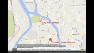
GeoCode performs geocoding functions in geopositioned maps in Autodesk® AutoCAD®. Pick a point in your map and GeoCode will display its full street address (or the address of the nearest location). Or enter a full address and GeoCode returns its lat-long coordinate plus creates a geomarker on this position (with the address as its label). You can also use it to geocode the what3words geolocation codes.
In AutoCAD you need to first set the GEOGRAPHICLOCATION of your map. Set your Google Maps API key before invoking the commands (see Help).
License: GeoCode is a free utility by CAD Studio - see Freeware.
For more information: Please see the below Videos :
关于此版本
版本 1.6.0, 2025/3/26
Added AutoCAD 2017/2018/2019/2020/2021/2022/2023/2024/2025/2026 support
Added the Google Maps API key support
Added the what3words geolocation service support, V3
Added the GEOCODEAPIKEYS command to enter your API keys
Keep option for labels


an interesting extension to the AutoCAD's Geographiclocation function
funguje!